Home › Services
Dock permitting: the part that decides everything else
Permitting is not paperwork that follows the design. It is the process that produces the design.
Why the permit comes first
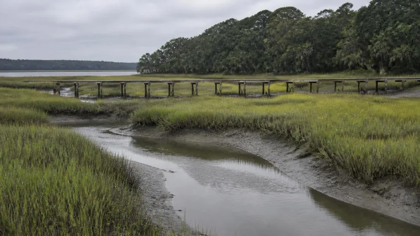
On your own high ground you are working inside a property right. Past the critical line you are asking to occupy tidelands held in public trust, and the answer to that request is what determines the dock.
This inverts the order people expect. Owners often arrive with a layout in mind and want to know what it costs. The useful question underneath is what the state will allow across that particular stretch of marsh, because until that is answered the layout is speculative.
The practical consequence is simple: money spent on design before the constraints are known is money at risk.
The critical line
The critical line is the surveyed landward boundary of the tidal marsh. It is a located line with a specific position on your plat, not a general idea about where the wet part starts.
Its position governs how much structure sits over tidelands, and that in turn drives the length of the walkway and the character of the whole project. A lot where the critical line runs close to buildable ground is a fundamentally different proposition from one with a long marsh apron, even if the two are neighbors.
If your survey does not show it, establishing it is the first piece of real work.
The joint process, in plain terms
South Carolina runs private dock authorization through the state coastal program, with the federal side brought into the same package rather than pursued separately. That is a genuine convenience compared with running two processes in parallel, but it does mean the submission has to satisfy more than one reviewer.
The application carries the survey, the proposed structure with dimensions, its position relative to the critical line and to neighboring structures, water depths, and the rationale for the footprint requested. Notice goes out. Comment is possible. Conditions may be attached to an approval.
The commonest avoidable delay is an incomplete submission. A package that goes in missing information does not sit still in the queue and get patched; it comes back, and the clock is not kind about it.
What gets decided
- Whether the lot qualifies for a dock at all.
- How far the walkway may extend and where it may run.
- The permitted pierhead footprint.
- Whether the pierhead may be covered.
- Whether a boat lift is allowed and of what kind.
- Where a float may sit and how large it may be.
- Conditions on construction method, timing or materials.
Why some lots do not qualify
This is the conversation worth having early, because it is the one that saves the most money.
Narrow marsh frontage is the common reason. Structures need separation from neighboring docks and from property lines, and a lot without enough width simply cannot accommodate the required clearances.
Water depth at the end of a reasonable run is another. If the achievable endpoint does not reach water that is meaningfully usable, the case for the structure weakens.
Protected bottom, shellfish resources and the character of the marsh being crossed all enter the review. So does the cumulative picture on a given creek.
And sometimes the answer was decided before you bought: subdivision-level agreements and prior arrangements can allocate or foreclose dock rights in ways that are not obvious from the lot itself.
What good preparation looks like
- A current survey that locates the critical line and the property boundaries.
- Depth information along the intended alignment at a known stage of tide.
- The position of neighboring structures.
- Any recorded restrictions or prior approvals touching the property.
- A design drawn to the constraints rather than to the wish list.
Applications built on that foundation move as fast as the process allows. Applications built on assumptions are the ones that generate a second round.
None of this is offered as legal advice, and the reviewing offices are the authority on their own requirements. It is a description of how the sequence usually runs for private docks in this county.
Working with neighbors and the creek as a whole
Dock permitting is not assessed purely lot by lot. Reviewers look at a creek as a system, and the structures already on it are part of the context for the one being proposed.
That has two practical consequences. The first is that early movers on a lightly developed creek generally face a simpler picture than later ones, because separation requirements and cumulative effects tighten as a waterway fills in. The second is that your neighbors are relevant parties rather than bystanders: the position of their structures constrains yours, and notice of your application may reach them.
It is usually worth a conversation before an application rather than after one. Not because agreement is required, but because an objection raised during review is slower and more expensive to resolve than a conversation held over a fence.
What to do if the answer is no
A declined application is not always the end of the matter, but it does change the question from what you wanted to what the site will support.
Sometimes the objection is to the footprint rather than the principle, and a smaller pierhead or a different alignment is approvable where the original was not. Sometimes the constraint is depth, and the honest answer is that the site does not support the kind of use the owner had in mind.
And sometimes the answer is genuinely no, permanently, because of frontage width or a restriction recorded long before you arrived. Hearing that early is worth a great deal, because the alternative is discovering it after paying for drawings.
Dock permitting — common questions
Do I need a survey before I apply?
Yes, and a current one that locates the critical line. An application built on an old or incomplete survey is the most common cause of an avoidable second round.
Is any of this legal advice?
No. This is a description of how the sequence usually runs for private docks in this county. The reviewing offices are the authority on their own requirements, and anything turning on a recorded restriction or a title question belongs with an attorney.
How long does a dock permit take in Charleston County?
Months rather than weeks, and it varies with the waterbody, the completeness of the application, whether comment is received, and current workload at the reviewing offices. Anyone offering a firm date at the outset is guessing.
Who actually issues the permit?
Private dock authorization in South Carolina tidelands runs through the state coastal management program, with the federal side handled in the same joint package. Local requirements can also apply depending on where the property sits.
Does a permit expire?
Authorizations carry validity periods and conditions, and letting one lapse before building can mean going back through the process. If there is going to be a long gap between approval and construction, that is worth understanding up front.
I am buying a lot that is advertised as dock-permittable. Is that reliable?
Treat it as a claim to verify rather than a fact to rely on. The things that decide it are checkable before closing: the critical line position, marsh frontage width, neighboring structures, depth, and any recorded restriction. Verifying is far cheaper than discovering afterwards.
Can I modify an existing permitted dock?
Changes to a permitted structure generally need to go back through review rather than being made unilaterally, and the threshold for what counts as a modification is lower than most owners assume. Repairing in kind and rebuilding are not treated identically.
Does the dock have to be built exactly as permitted?
Yes. The approved drawings and conditions are the authorization. Building something materially different from what was approved creates a compliance problem even when the result is smaller or seems more modest.
Talk through your site
Start with the survey and the critical line. Everything else follows from those two things.
Related work
Dock Construction
New private docks built for the creek you actually have.
Boat Lifts
Lift selection sized to the boat, the tide range and the pierhead.
Floating Docks
Floaters and ramps that stay usable through a six-foot tide swing.
Pierheads & Walkways
The walkway across the marsh and the pierhead at the end of it.
Dock Repair & Rebuilds
Decking, stringers, piles and hardware on an existing structure.
Where we do it
Mount Pleasant
Shem Creek to the Wando, and everything off Rifle Range Road.
Sullivan's Island
Cove Inlet and the back-island creeks.
Isle of Palms
The Intracoastal side, Hamlin Sound and the marina reach.
Daniel Island
Beresford Creek, Ralston Creek and the Wando frontage.
James Island
Ellis Creek, Clark Sound and the Stono side.
Johns Island
Bohicket, Church Creek and the deep Stono bends.